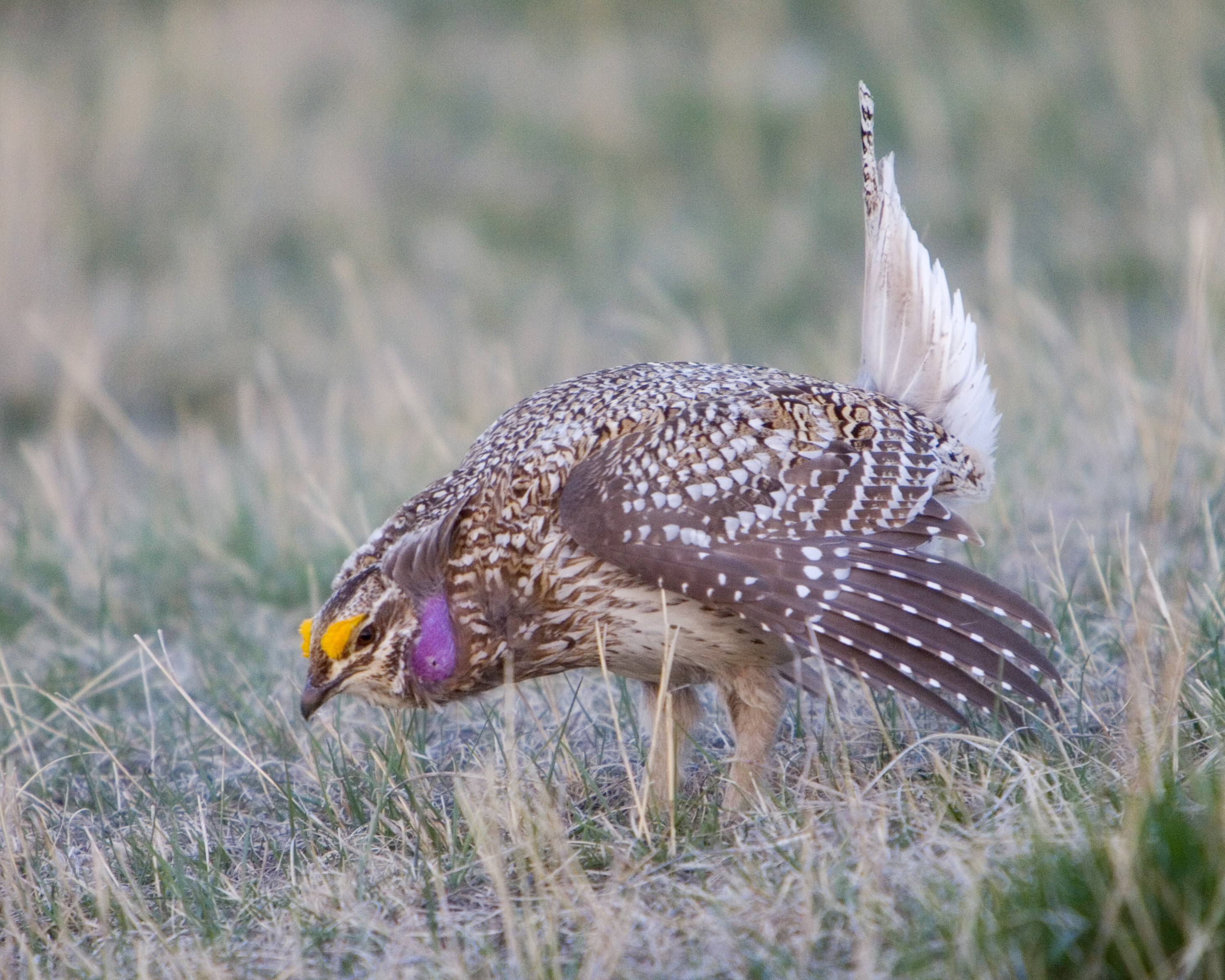
Sharp-tailed Grouse and Greater Prairie-chicken
Sharp-tailed grouse (Sharptails) and greater prairie-chickens, collectively referred to as prairie grouse, are closely related native birds that are primarily distributed across prairie-dominated landscapes of central and western South Dakota.
Sharptails have a relatively short tail with two central feathers somewhat longer and darker than the outer tail feathers, accounting for its name. The plumage is mottled dark and light browns against a light background. Prairie chickens have a tail that is short, dark, and rounded.
Prairie grouse hunting typically occurs on large expanses of grassland, but can occur in cropland or field edges in grassland dominated landscapes. These birds are usually found in coveys which tend to increase in size as the season progresses. Prairie grouse are commonly found in mixed flocks where these species’ range overlaps.

.jpg)
Daily Limit:
3 (includes ruffed grouse)Possession Limit:
15 (includes ruffed grouse)Open Area:
StatewideShooting Hours:
Sunrise to sunset statewide.Residents:
Small Game, any Combination license, Youth Small Game, Mentored Small Game, or 1-Day Small GameNonresidents:
Nonresident Small Game, Nonresident Mentored Small Game, or Nonresident Youth Small GameLocations:
| County | Description | Longitude | Latitude |
|---|---|---|---|
| Lyman | Fort Pierre National Grasslands | -100.3270 | 43.9993 |
| Jones | Fort Pierre National Grasslands | -100.4037 | 44.1251 |
| Stanley | Fort Pierre National Grasslands | -100.3883 | 44.1975 |
| Stanley | Fort Pierre National Grasslands | -100.2504 | 44.2092 |
| Lyman | Fort Pierre National Grasslands | -100.1464 | 44.1220 |
| Lyman | Fort Pierre National Grasslands | -100.2266 | 44.0933 |
| Stanley | Located approximately 24 miles northwest of Pierre at the intersection of Hwy 1806 and Sansarc Road. | -100.6778 | 44.4948 |
| Stanley | Lcoated approximately 10 miles west of the Hwy 1806 and Sansarc Road intersection. | -100.8762 | 44.5025 |
| Stanley | Located approximately 2.5 miles west and 5.5 miles north of Hayes, SD on N Brown Church Road. | -101.0743 | 44.45506 |
| Jackson | 2 miles east and 3 miles south of Cottonwood on BGNG, west side of road at T-intersection. | -101.8604 | 43.9221 |
| Haakon | 10.5 miles north and 1.5 miles east of Philip on McIllravy WIA. | -101.6377 | 44.1972 |
| Perkins | 6.6 miles north of Bison, west side of White Butte Road along entrance to GRNG Road. | -102.4571 | 45.6216 |
| Perkins | At gate on west side of road 1.5 miles north of buildings at Bessler Management Unit along Bixby Road. | -102.5661 | 45.4098 |
| Perkins | On GRNG Road approach 13.5 miles north of Meadow Corner or about 4 miles south of Summerville on Hwy 73. | -102.1667 | 45.7217 |
| Pennington | 1.5 miles south and 5 miles west of Wall on School and Public Land. | -102.3384 | 43.9645 |
| Perkins | Shadehill Campground cleaning station | -102.2311 | 45.7611 |
| Butte | Newell DOT Property | -103.4194 | 44.7196 |
| Bennett | From junction of Hwy 18 and 73, 5 miles north, 7 miles east and 4 miles north at T-intersection on Walk in Area | -101.3763 | 43.3452 |

