Mina Lake Recreation Area offers a peaceful retreat where visitors can enjoy a blend of outdoor recreation and natural beauty. The park provides a well-maintained campground with 37 electrical campsites, one tent site, one camping cabin, and a modern cabin. The lake is a popular destination for fishing, boating, and swimming, with a sandy beach and large picnic area to spend your day outdoors. With accessible hiking trails that meander through the scenic surroundings, and ample opportunities for wildlife viewing, Mina Lake Recreation Area is a year-round haven for families, anglers, and nature lovers seeking a serene escape
Mina Lake Modern Lodging
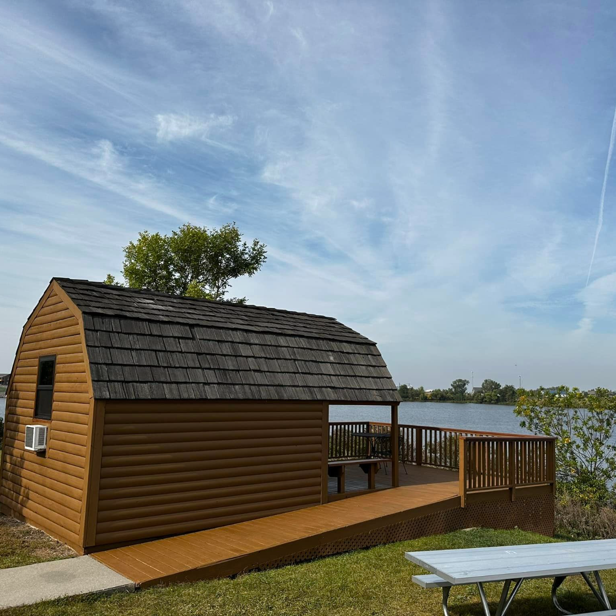
The modern cabin at Mina Lake offers increased comfort and privacy in an outdoor setting during any time of the year. It features heating, air conditioning, electricity, a full kitchen, and a fully ADA bathroom and shower. The modern cabin is located away from the campground, offering peaceful lake views, shoreline access, a private small dock you can fish from, and plenty of space for the kids and dogs to run around.
Modern Cabin
A modern cabin is a single rental structure with multiple rooms, including a bathroom. The number of bedrooms, maximum occupants, extent of kitchen facilities and availability of other amenities may vary by unit. Price per night.
Modern cabin: two bedrooms, sleeps 10 | $150 (additional $10 per person for up to 15 guests)

Reservations
- CampSD.com
- 1.800.710.2267 (additional $6 fee for residents or $16 fee for non-residents).
- Minimum two-night stay required.
- Can be reserved as much as one year before arrival.
- Reservations must be made by midnight two days prior to your arrival.
- Cancellations: $25 fee per reservation if cancelled more than 30 days before arrival. $25 per night fee if cancelled within 30 days of arrival.
Regulations
- Check-in: 4 p.m. CT
- Check-out: 11 a.m. CT
- No smoking allowed inside.
- Park curfew/quiet hours are 11 p.m. to 6 a.m. Visitors must depart at 11 p.m.
- Bath towels, linens, personal hygiene products, and housekeeping services are not provided.
- A cleaning fee will be assessed if the facility requires more than standard cleaning.
- Camping units and tents cannot be placed outside. Please reserve a campsite in the campground.
- Park entrance license required for all vehicles.
- Special event application required for events involving 50 or more people.
See More
Read More About This Park