Scenic Drives
Photo © SD Tourism
(SD Hwy 87 North)
Distance: 14 miles
Expected travel time: 60+ minutes
Tunnels:
Needles Eye Tunnel (Near Needle's Eye), 8' 0" wide by 9’9" high;
Iron Creek Tunnel, 8' 9" wide by 10’10” high.
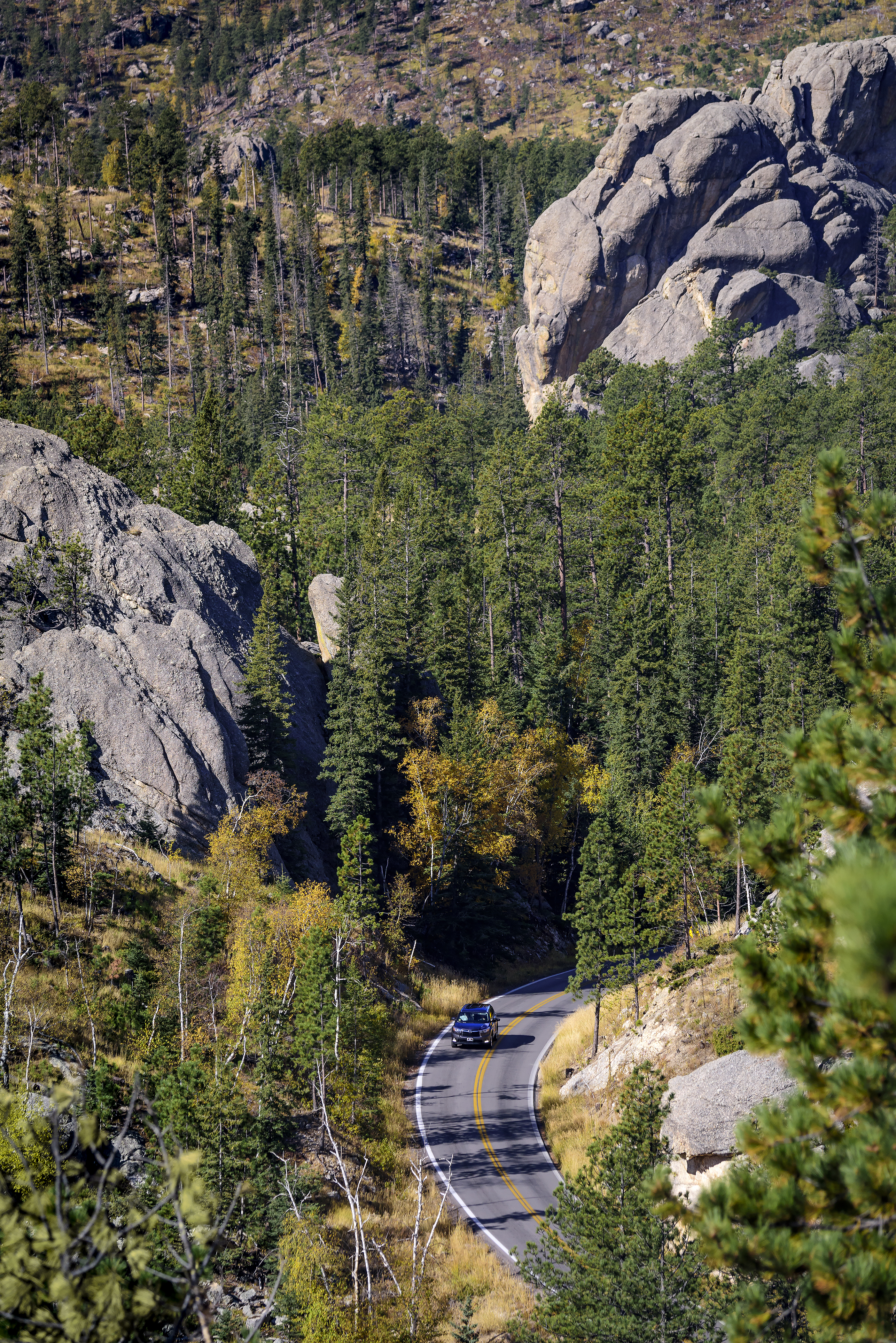
The Needles Highway is a spectacular drive through ponderosa pine and Black Hills spruce forests, meadows surrounded by birch and aspen, and rugged granite mountains.
The road's name comes from the needle-like granite formations, which seem to pierce the horizon along the highway.
The roadway was carefully planned by former South Dakota Governor Peter Norbeck, who marked the entire course on foot and by horseback. Construction was completed in 1922.
Visitors traveling the highway pass Sylvan Lake and a unique rock formation called the Needle's Eye, named for the opening eroded by wind, rain, freezing, and thawing.
Needles Highway closes to vehicles with the first snow of the season and does not reopen until April 1, or later depending on conditions. When the right conditions present themselves, Needles Highway is open for hiking, biking, snowshoeing, and skiing while closed to motor vehicles.
.jpg)
Distance: 17 miles
Expected travel time: 60+ minutes
Tunnels:
Doane Robinson Tunnel, 12' 0" wide by 11' 4" high;
C.C. Gideon Tunnel, 11' 6" wide by 10' 9" high;
Scovel Johnson Tunnel, 10' 9" wide by 11' 0" high.
The Iron Mountain Road is a work of art alone. The highway connects Custer State Park to Mount Rushmore National Memorial and passes through some of the most beautiful scenery in the Black Hills, including three tunnels that frame Mount Rushmore in the distance. The road is famous for the "Pigtail Bridges" that allow travelers to drop or gain altitude quickly.
The highway was constructed in the 1930s under the direction of Governor Peter Norbeck, "this is not meant to be a super highway, to do the scenery justice you should drive no more than 20 mph and to do it full justice you should simply get out and walk." Experience the road that engineers once said couldn't be built; you'll be happy you did.
Iron Mountain Road does close periodically during the winter depending on conditions and how quickly the road can be cleared safely.
.jpg)
Distance: 18 miles
Expected travel time: 1 hour 30 minutes—travel time is dependent on “wildlife jams.”
From the intersection of Wildlife Loop Road and SD Highway 87, US Highway 16A is five miles north.
Wildlife Loop Road twists and turns its way through the prairie and ponderosa pine-studded hills that harbor many of the park's wildlife species. On most days, guests will come face to face with the number one inhabitant of the park, 1,350 free roaming buffalo. White-tailed deer, mule deer, and elk are most visible early in the morning and late in the afternoon; if you're lucky, you may see big horn sheep, burrowing owls, coyotes, or even a mountain lions. Two of the most colorful characters along the way are the prairie dogs and a band of the park’s feral burros.
When to travel: The best time to view animals along the Wildlife Loop Road is early morning or late in the evening, just before sunset. The road is open year-round but does require careful driving during winter conditions.